

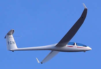
The Glider
A GLIDER, OR SAILPLANE, is a type of aircraft that does not have an engine. Usually, an airplane tows the glider aloft, although the glider may also be launched like a kite, using a winch or even an automobile to pull it into the air. At the desired altitude, the glider pilot releases the towline, and begins to glide.
To learn to fly a glider, you must take lessons from a Certified Flight Instructor in Gliders (CFIG) until you meet the requirements for a Private Pilot Certificate. The Federal Aviation Administration certifies instructors and private pilots. You can solo a glider at age 14, and can obtain your private pilot certificate in gliders at age 16. As long as you are able to safely fly the glider, there are no medical certificate requirements in gliders as there are in airplanes.

Lift
If the air is still, the glider slowly descends to a landing. However, the air is rarely completely still. Often updrafts, or "lift", exist which a skilled pilot can use to gain altitude.
The most common type of lift that a glider pilot uses is called a thermal. A thermal is a bubble or column of warm air that is rising. Warm air rises because it is less dense than cool air. Often a cumulus cloud will form at the top of the thermal, marking the area of lift.
By flying in circles in a thermal, a glider pilot can climb thousands of feet into the air, and stay aloft as long as the lift persists. Most people have seen hawks, eagles, and vultures use this same technique to gain altitude without flapping.

Racing
In a sailplane race, a course is set around one or more turnpoints, with a finish line at or near the starting airport. Typically, a sailplane contest lasts several days, with one race being held on each day.
Before the race starts, all the sailplanes are lined up on the runway. Once the lift is strong enough, the gliders are towed aloft to an altitude of 2,000' above the ground. After all of the gliders have been launched, the race is started. The pilots must then fly from the start, around the turnpoint(s), and back to the finish line. Global Positioning System (GPS) data is used to verify that the sailplanes flew around the turnpoints. Several factors determine how long it takes the sailplane to fly around the course. These include how fast the pilot can climb in the thermals, how fast the pilot flies between thermals, and how much "sink" the pilot encounters while gliding. Often, a pilot will pass up a weak thermal and instead continue gliding in search of a stronger one. Of course, if the pilot is getting low and is in danger of "landing out", any lift, no matter how weak, will suffice!

The winner of a race is awarded 1000 points, with each finisher (i.e. pilots who made it all the way around the course) receiving a fraction of 1000 points determine by the ratio of their speed to the winners speed. Non-finishers (pilots who did NOT make it around the course) are awarded points based on how far they made it around the course, but they always receive fewer points than the slowest finisher. The winner is the pilot who accumulates the most points at the end of the contest.
Soaring Academy’s Favorite Lift Sources
SUMMER (April through October)
THE SAN GABRIEL MOUNTAINS
When flying mornings in the April-October season, you can expect terrific thermal lift over the higher ridges of the San Gabriel Mountains. Because they are mostly very steep and narrow at the top, in light winds it is possible to fly along directly above the crests, climbing steadily in thermal lift from both sides at once. Then, wherever multiple faces meet at prominent peaks, tremendous thermals flow together and offer climbs that are sometimes unbelievable. I have been at 13,000 MSL before 11:00 AM. If you're going cross-country and cumulus clouds are not already forming over the desert, don't leave the mountains before about noon. Then, by the time you have glided 30 miles, thermals should have triggered over the flat desert.
1. MORNING MOUNTAIN
Very often, the first thermal of the day rises from this smallest of the bigger mountains. It's southeast face is bare rock, facing the morning sun and also facing into a huge canyon that protects it from almost any wind direction. We have found 6 knot thermals there as early as 9:30 AM, when nothing else was working yet. Within an hour of the first lift there, that small hill is dwarfed by even better lift from bigger terrain all around it.
2. MINGHELLI'S CHIMNEY
Located on the south side of the `second', or `middle' ridge (officially named Pinyon Ridge), crest elevation: 6500 feet MSL. This ridge produces very strong thermals, April through October, starting about an hour before thermals trigger on lower ground. There is seldom any need to tow higher or farther for a good start to a great flight.
3. THE LABOR CAMP
At the east end of Fenner Canyon, between the second ridge and the big mountains, Baden-Powell and Lewis. Air flowing in from the west is forced up at head of the canyon. From these lower thermal sources you can get high enough to attack the bigger terrain and search for even better lift.
4. MOUNT LEWIS
At 8300 feet, this mountain is far from the largest in our area, but is usually the best. It is an isolated cone with about five different faces that meet at a sharp peak (the side that faces the afternoon sun is dark brown rock…). On any given summer afternoon, Mt. Lewis is where you'll probably find the best thermal for a hundred miles or more!
THE DESERT
1. HOUSE THERMALS GALORE
The runway and areas all around produce thermals that last about ten minutes each. When the one you are using is gone, look at the orange tetrahedron. Since it points into the surface wind, the next new thermal from the open ground of the airport will probably be straight downwind of it. "What goes up must come from somewhere."
2. THE DRY WASH
Big Rock Wash runs south to north, west of the airport. The stones are light gray, so I doubt that they heat very much, but the dry, sandy and darker areas on either side are the likely heat sources. The lift will be found over the wash.
3. BOB'S GAP
A mile and a half south of the airport a ridge runs east to west, which we call the `first ridge'. It is very small, and usually insignificant, but if you're low you can often make a save over a gap in the hill where air flowing either direction is broken loose from the surface.
4. SHEAR LINE LIFT
Upwind of the airport in the afternoon, look for hazy air pushing into the desert from the Highway 14 pass (Palmdale). Strong lift is to be found on the margin between the visible marine air and the clear desert air. Stay on the clear side.
5. PINYON HILLS - PHELAN
The west edge of the Cajon Pass shear line produces dust devils and very strong lift running from the mountains north to El Mirage Dry Lake and beyond. (Basically the same phenomenon as the shear line west of Crystalaire.)
6. NORTH OF WRIGHTWOOD
There is a tan colored alluvial fan large enough to be seen in satellite photographs. Devoid of vegetation, it gets hotter than the surface surrounding it, and therefore produces stronger thermals.
7. EL MIRAGE DRY LAKE
During the afternoon, large, very strong thermals last a long time there. This is due to the huge reservoir of super-heated air than collects on the lake bed throughout the first half of the day.
8. GRAY BUTTE
An old military airport lies just east of a dark cone of rock standing alone in the flat desert. Both features heat up more than the vegetation surrounding them, and provide dependable lift all afternoon.
WINTER (November through March)
WINTER LIFT SOURCES THAT REACH HIGH ALTITUDES CONSIST OF WIND-DRIVEN FORCES: SLOPE LIFT AND WAVES.
When public weather stations forecast strong winds below canyons in the Los Angeles basin (the "Santa Anna winds"), you can be fairly certain that we have good ridge soaring - and possible waves standing well upwind of the Mountains. I call them `bow' waves (rhymes with WOW!)
When rain is forecast in LA, with chances of rain in the desert, we expect conventional wave activity on both the day before and the day of the forecast rain. Then, when the front actually arrives, we often have cumulus clouds to mark the lift. The shear lines, although usually weaker in winter, can sometimes work well, too.
On a flight one December , we were running near cloud base at about 100 knots for as far as time allowed before turning back. The cloud base was low for this area (only a mile above the surface), but the lift that day was as strong and consistent as a typical day in summer.
THINK OF IT: CROSS-COUNTRY SOARING AT RESPECTABLE GROUND SPEEDS IN DECEMBER!
FOR SLOPE LIFT, the `second' ridge or the base of the big mountains south of the Devil's Punchbowl are good places to start. I like to soar to the west along Pleasant View Ridge. It's gentler terrain than many mountains in this area, and is easy to work. From the west end, turn back and make another pass. After reaching 9000 feet, you can go for the bigger terrain to get even higher - and look for wave.
FOR CLASSIC WAVE conditions in any wind from southeast to southwest, there could hardly be a more predictable spot than the Devil's Punchbowl. It is sometimes easy to thermal into wave there, or release after a three or four thousand foot tow, and climb away. We have even had fast climbs to 17,900 when the wind is from the west, parallel to the mountain chain!
When the wave is working at the Punchbowl, we usually have a secondary just about directly over the airport - and who knows how many harmonics downwind into the desert. We have plenty of opportunities to practice our thermaling skills in the winter, too. Sun-facing mountain sides often work consistently, and with post-frontal instability, we sometimes find usable thermals over the open desert as well. Also, in light northeast winds (common in winter), we have an amazingly predictable lift source: a wide pattern of dune-like ripples that act as a thermal trigger. The ripples lie less than two miles directly upwind from the airport, so that drift brings you toward the field - a pleasant convenience when scratching in weak winter thermals.
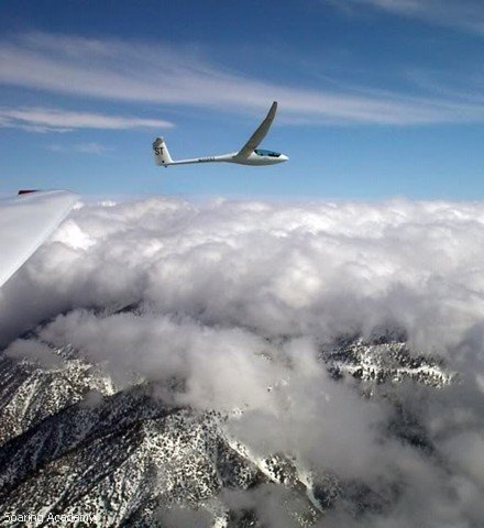
Winter wave here over the mountains. Picture by Dale Masters and Juliet Lima. (DG-500).
3D Views of Local Lift Sources
These are our local mountains, looking southeast.
Click the image to see a larger view.
The orange numbers are statute miles from Crystal airport.
The red initials indicate special sweet spots where its usually possible to climb from low hills up onto the BIG ones.
FIRST, NOTE THAT THE NORTH ARROW POINTS DOWN AND TO THE LEFT. THE NORTH SLOPES ALSO ARE SHADED. STRAIGHT UP IN THIS VIEW IS SOUTHEAST.

Now, where to start? Let's begin in the morning with our typical light wind. As early as 9:00 AM, you can tow to Morning Mountain (MM) to catch the day's first thermal. You'll need a minimum of about 6500 feet of altitude (3100 feet higher than the airport.) which is just slightly lower than the peak. This earliest lift rises over the dark rocks of the steep southeast face, and requires very narrow circles either southeast of the peak or directly above it. As the lift builds and you gain altitude, you can work your way south, up the ridge, toward the higher crest of Mt. Williamson. Within an hour or less this earliest lift will be dwarfed by bigger, stronger, thermals from all around the area. Another advantage of this as an early starting point: if you fail to find lift you can glide northeast across the canyon (to the left in this view), to Pinyon Ridge and still have a good chance of hanging on a little lower. Even the few minutes it takes to get there may allow enough extra time for other thermals to begin.
THE LOCALS HERE MOST OFTEN REFER TO PINYON RIDGE AS "THE SECOND RIDGE"
Despite its unspectacular appearance, it's an amazingly dependable source of thermal lift - plus lots of other good stuff as well. There are three especially sweet spots on the south face, but throughout the day there is often solid weak lift or zero sink with very strong thermals imbedded along the full length of Pinyon Ridge. The 'work camp' (WC) is at its best in west winds, when the canyon upwind feeds it with extra energy. The lift drifts up over the head of the canyon, to the left in this view.
Minghelli's Chimney (C) is usually the very best. It sometimes starts as early as Morning Mountain, and it typically works all day, to the very end. On any afternoon from March to November, there may be soarable lift at the Chimney all the time. And in winter, when there may be no other thermals anywhere, there is probably at least something happening here.
TONY'S CORNER (TC) IS BEST AT OTHER TIMES FOR OTHER REASONS

Situated at the west end of Pinyon Ridge, it has maximum exposure to both south and west winds, and receives the best sun exposure late every day of the year. (The one condition that can spoil thermal lift on Pinyon Ridge is a strong south wind bringing downslope sink from higher terrain. But even then, Tony's Corner lies directly in the way of the solid wind flowing down the big canyon between Morning Mountain and Mt. Lewis. This, therefore, is one of the very best places to climb from down low, up into WAVE. So much for the big four little places. Now what about all the fantastic lift everywhere else on a typical day at Crystal? East of the work camp a small notch leads up to a bigger, longer hill named Blue Ridge, which is often not as ideal as Pinyon. Yet, at other times IT is the prime location for very strong shearlines - and other goodies.
In light winds from any direction there is generally good to very strong thermal lift directly above any sharp ridge crests or peaks in our local mountains - and there are miles of those nearby. From a first climb at Morning Mountain or Pinyon Ridge, the best next step is usually Mt LEWIS. This is perhaps the finest thermal source for 90 miles or more in any direction. REALLY. Often you can approach this 8100 foot mountain, even below the peak, and simply fly around it once or twice, climbing almost all the while. Here you can expect numerous thermals from all sides at once, joining at the top. Above this peak the thermal lift just goes on up and up… But even before climbing high, from there you can run south, across Route 2, up the ridge to 9000 foot Throop Peak. On the way, the lift will probably be continuous, so long as you stay directly above the ridge crest. Imagine heading straight toward a peak that lies above you, and lowering the nose as you gradually rise up, over the highest point! From there you either do a 270 degree right turn before heading east, to sample the thermal above that peak, or simply bang a left and run on, through plenty of ridge-top thermals, east to the highest peak in the local area, Mt. Baden Powell. Here again, as at Mt. Lewis, we have an isolated cone collecting thermals from several different faces, and more lift than you may know what to do with.
Here it might be a good idea to climb a bit - at least to 10 or 12 thousand feet - before running on across a large canyon to the ski area atop Blue Ridge, four or five miles northeast.
NOTE THAT THE NORTH ARROW IS POINTING STRAIGHT DOWN (IT'S ALSO POINTING IN THE DIRECTION OF CRYSTAL AIRPORT, WHICH IS ABOUT THREE MILES OFF THE MAP.

Often at Crystal, SHEARLINES are the best thing on the menu. We discuss the mechanics of soaring shearlines on the next page down, but for now let's just say that the yellow ones operate much of the time. As the day goes on, they usually migrate inland (to the north or east), and when they do, the orange ones build in from the west. The big shear that exits our map to the lower left usually runs solid to the north, clear across the Antelope Valley, to El Mirage, and then northeast toward Barstow.
Soaring Safety Tips
Click on an image to view a larger size and view additional safety information.


Ridge Soaring
Ridge soaring is an interesting study in contrasts. Windward slopes offer lift that is easy to work, but can also be quite hazardous. The flow of air may be glassy smooth, or contain turbulence that is at times prohibitive. It might make cross-country flights possible for even the least experienced of pilots in low performance gliders, but usually requires operating extensively in very close proximity to the earth - in some places only moments from landing if a situation is not handled properly. Also, experience in soaring on only one type of slope could engender a confidence that is unwarranted when facing a very different set of circumstances elsewhere.
Therefore, even a seasoned pilot is wise to procure a local checkout before soaring on hills of an unfamiliar nature. While at the basic level there seems little to it (simply fly parallel to the slope and be sure not to hit anything), ridge soaring at its best actually presents as many subtleties, and will reward finesse every bit as much as thermal soaring. The great advantage is that it's often possible for even a beginner to stay aloft indefinitely and advance more quickly through the learning process, whereas one small mistake is usually all it takes to shoot down the same beginner in thermal conditions.
Reading The Terrain
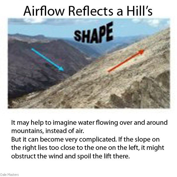
A number of different tactics may be used in ridge soaring. The most appropriate one for a given circumstance is dictated by the specific type of hill (its shape and size), and the idiosyncrasies of the resulting airflow. Perhaps the simplest way to analyze sloping ground for its usefulness in ridge soaring is to distinguish between sections of terrain that act as COLLECTORS and/or DIVIDERS.
Slopes and bowls that more or less directly face the wind collect it and concentrate any available lift. But slopes angled away from the wind, or protrusions into it, tend to deflect or divide the flow, either ruining lift or focusing it elsewhere. Which parts of a mountain function in which way depends upon the existing conditions (primarily wind strength and direction, but also including other interrelated factors). Such relationships constantly shift with changes in the weather and sun angle.
Even a concave feature that collects and concentrates wind from a broad area may not always produce good lift. Whether it's a shallow indentation or a spectacular canyon, change in wind or sun angle can transform it from a terrific lift source to a deadly sinkhole - or the reverse - in less than an hour. A convex feature can be even more unpredictable. It may tend to divide wind flow, but if wide enough and oriented properly, might itself act as an individual ridge or thermal trigger. Depending on the vagaries of other surrounding influences, a particular mountainside could even switch back and forth from one effect to the other every few minutes.
As a slope changes shape beneath the onrushing sailplane, adjustments must be made on a moment-by-moment basis. For instance, even a small protrusion lying upwind, lower than the one you are working, may interrupt the lift a mile or more downwind. If you come upon such a disturbance and have enough altitude or speed to sail across it, you can probably expect a return of soarable lift just beyond. But what if it doesn't work that way?
Some hills offer lift at such low altitudes that a loss of three or four hundred feet means landing out, and if so, the critical decision whether to continue on or turn back must be made very quickly. Experience will help in anticipating how a given wind might flow over variations in the surface, but, whatever your level of expertise, it is important to constantly study the route ahead and use imagination to interpret whatever information is available before flying close to high terrain.
It's usually best to attack the nearest or highest point within reach first, and then explore progressively lower areas as you descend in search of lift. A high, steep slope may sometimes provide good lift well below the crest, making it possible to arrive there low and gradually climb the hill, but it's not always that easy. When you do find yourself working lift below the top of a hill, do not assume that you'll be able to maintain one altitude indefinitely. If instead you begin to lose altitude, the slope encroaching from below will quickly shrink your usable airspace.
General Rule
So remember this general rule: the closer you are to terrain that extends above you, the more important it is to either climb or get away. Also, when ridge soaring in convective conditions expect strong, possibly violent sink at any time, usually tending to roll you toward the nearby mountain. If you're too close to steep terrain without sufficient speed or room to dive away, a thermal or rotor just upwind can kill you in seconds! Always carry extra speed whenever you're very near or moving toward the terrain, and keep ample room on the windward side for diving away.
Pilots unfamiliar with slope soaring may be tempted to fly directly over the crest of a hill, and this can quickly prove to be very hazardous. If the wind is flowing from only one direction, then the crest will be where that flow levels out and starts back down; unless you find a thermal, there may be no lift over the summit itself! Meanwhile, a sailplane aligned parallel to the slope (and more or less perpendicular to the wind) will drift steadily downwind across the top, and when the sink finally grabs its downwind wing there may be no choice but to turn the wrong way, downwind, into deepening sink. Even worse, many ridge tops are so broad and flat that gliding clear across them in this situation is impossible...
However, if a ridge has wind blowing up both sides, and especially if its sides are steep and it's sharp on top, following the actual watershed may be a most useful technique. The combination of slope lift and thermals coming from both sides may make the ridge top soarable even when there is insufficient lift of either kind on either side. Yet this is inherently hazardous stuff for several reasons. First, the crest directly beneath you is impossible to see, and it (or the tree tops on it) may rise and fall abruptly as you fly along.
Also, the localized airflow might be extremely inconsistent - especially if thermals are strong - and sudden sink is a serious possibility. When the bottom drops out, you could be forced to turn away from terrain in a direction that would leave the ridge standing high between you and a safe landing. If you are not already fairly familiar with mountain soaring, save this adventure for later, and don't try it at all until someone with more experience has demonstrated that it is workable and safe on any particular hill. Too many soaring pilots have already crashed on ridge tops; we don't need more!
Even very large and/or steep mountain slopes can be useless for ridge soaring if they are serrated by multiple drainage patterns. Airflow typically reflects the shape of the hill. So in ragged terrain the most windward points act principally as dividers, deflecting the best lift so far back into sharp ravines that working it becomes dangerous.
Be very leery of flying too far back into long, narrowing canyons, especially when wind is striking the overall slope diagonally. The lift may seem fine at the outer end where the canyon is wider, but as you proceed toward the head of such a canyon the spur upwind will sneak closer until at some point it dumps turbulent sink directly onto your ridge. Then, suddenly, you're descending into rising terrain, needing to turn away in very limited airspace toward the increasing sink from that other ridge. As the sink deepens, you could find yourself diving for survival, straight downstream, horribly close to a high canyon floor - beneath the lift you were using moments before. In addition to all these problems, as the hills rise around you they might require a circuitous and much longer route back out to the safety of open airspace - perhaps farther than you have sufficient altitude for. In seconds, this scenario can become a genuine dead end!
Real Life Example
One real-life case in point involves all the above hazards in very big and complex terrain, made even more serious by our having never been there before. We were at least six thousand feet higher than the valley we had come from, and were climbing with ease, holding an even distance above the ascending spine of a steep ridge. Although our slope was itself quite large by ordinary standards, it was merely a secondary watershed extending almost perpendicular from the towering crags of the main summit far above. To complicate matters further, the actual wind aloft was from the far side of that enormous mountain, reaching our hill only after dumping over and curling around.
The lift was weak but steady, yet the spectacle of gorgeous stair-step lakes sliding into view as we rose was very distracting. Then we rounded a bend and suddenly realized that the canyon floor had been rising even steeper than the crest of our ridge. Just ahead the slope below us dwindled to nothing, our canyon narrowing to a small alpine meadow surrounded by granite walls further up. Since we were unfamiliar with this area, not only did we lack anticipation of what lay around every rocky corner, we also had no local knowledge or feel for how the ever-higher terrain might affect our fortunes... We immediately turned back out toward safety, but so little room was left beneath us that some heavy sink from the snowfields overhead, a bit of indecisiveness, or fear-inspired sloppy stick work could have made it a very close thing!
A Timely Retreat
The key to our finally soaring over the great summit lay in that timely retreat. Other subtle hazards also lie in deep canyon terrain, waiting to trap the unsuspecting pilot. Imagine a wide stretch of high ridge with two spurs extending out from it, not quite parallel to each other, but closer at the bottom than at the top. The mouth of the canyon, then, is narrower than the top, and wind that flows in will tend to spread out rather than converge and rise.
A soaring pilot attempting to cross such a canyon from below the upper ridge could find mostly sink and be obligated to turn away for a downhill run into the wind just to escape the canyon alive! Also, the more complex any piece of terrain is, the more likely it is to produce sudden, radical - unpredictable - changes in air flow
Slope Hazards
Think of it this way: flying near a single slope is relatively more hazardous than in completely open air space, and flying near two slopes doubles that level of hazard. But when your long-winged aircraft is actually surrounded by rocks, your freedom of movement is so restricted that even a bit of thermal sink could be very bad news indeed! Here we're talking about one of the most perilous situations in soaring, and, although it may offer tempting results, it is no time for cockiness.
So again, if you don't honestly believe you're already a pretty good stick-and-rudder pilot who can fly unusual attitudes in extremely dynamic conditions without using the instruments, do us all a favor and just stay away from deep declivities in high terrain.
If you do decide to tackle such an environment, however, a careful but confident aggressiveness is vital. Even so, you must earn your confidence gradually, in various conditions, and expect many hair-raising surprises! There are places where an entire range of mountains offers no good slope lift in the conventional sense near the surface, although we may find lift that feels more like wave a short distance upwind. (Or perhaps powerful slope lift near the surface leads directly up into this wavelike lift - plus more of the same further upwind of the mountain.)
Some pundits would argue on technical principles that unless there is down-sloping terrain upwind, it cannot be an actual wave. Maybe so, but nevertheless, in terms of using it effectively, it may help to think of this sort of lift as a kind of wave. Air is piling up the way river water does on the upstream side of a bridge pier.
It may be better to work such lift by facing the wind and hovering, more or less stationary relative to the hillside, rather than tacking along it. This soaring condition may remain steady all day, but can also flow through with the wind or suddenly break. When it does, penetrate a short distance looking for another surge of lift forming upwind. If you find zero sink, circle in it (or figure-eight) while drifting back to where the lift was before. There, the rising of terrain beneath you might again strengthen zero-sink. If your mountain is large and steep enough and presents a wide enough obstruction to the wind, there can actually be more wave further upwind, well away from the hill (like a secondary wave, only reversed). (Such a condition implies relatively stable air at that altitude, and therefore indicates a possibility of more conventional wave downwind of these same mountains...)
Density Altitude - it's everywhere!
Most pilots seem to think of density altitude as a problem only during takeoff and landing, but in the high country it can be like having the Devil for a co-pilot. Remember that the atmosphere is about two percent thinner for every thousand feet above sea level. If you're maneuvering in the head of a canyon at ten thousand feet, you'll need another forty percent more room to complete a turn - plus considerably more if it's a hot afternoon in July with even warmer air surging up from below.
At the other extreme, even very low and shallow slopes can produce perfect ridge lift - so long as they are smooth and uniform. Over terrain such as the Appalachian ridges it is often possible to push a sailplane all the way down to a wingspan or two from the surface, converting the stronger lift there into greater airspeed. Of course, the lower you run a ridge, the more speed you need - not only for maneuverability, but also to skip across short sections of sink.
If it's a truly 'ridge-runnable' day, there will be plenty of lift to make high speeds near the surface a safe and practical possibility. If not, don't try it; it is not worth the risk! There is, after all, so little air being collected by low or shallow slopes that, even in strong wind the likelihood of climbing from below the crest is quite slim. Besides, in such small terrain you might not be much above landing pattern height for long stretches of time and/or distance. Therefore, in regard to the lowest of ridges, your rule should be: don't even try to soar below the crest!
This last example, and our earlier story about nearly having to land in an alpine meadow, both suggest a very important point that may sound trite but is sometimes not really obvious when you're up there soaring. It's easy to be lured onto a hill where there is too little slope beneath you to provide sufficient lift. The bottom of a slope (especially the bottom of a canyon) is no place to be in an aircraft of any kind, particularly one with no thrust!
To this we must add some further subtleties about changes in the degree of slope. Whether the slope is convex or concave, either kind of inconsistency can cause airflow to separate from the surface (just as it does due to unsmoothness in the surface of a sailplane wing), and therefore seriously weaken orographic lift. If this does happen, you could find yourself suddenly descending onto terrain directly below you at close range - terrain which is by definition flatter/wider, and therefore harder to fly safely away from. There is a potential bright side to this phenomenon: the place where upslope winds separate from the surface is exactly where a thermal is most likely to do the same! So, whether you're climbing by a change in slope or rushing by it horizontally, look -and FEEL - for a change in lift rate, and if it weakens, or if there is increased turbulence, look immediately upwind (away from the hill) for a possible thermal.
Always remember, too, that sloping terrain above you promises nothing; it's the terrain below you that counts! (The same is true of thermal hunting, of course; those black rocks may be hot enough to cook on, but if you're looking horizontally at them, the lift they're kicking off will all be above you and out of reach!)
Even in the absence of strong wind, the day's first lift normally will be found above some sort of sloping ground. If sun and wind are coming from approximately the same direction, lift should be easy to locate. However, if they oppose each other at an odd angle, it may be so broken or intermittent that simply staying up is a great challenge. But whether it amounts to weak thermals enhancing ridge lift or vice versa, either can usually be expected to strengthen as the sun rises in the sky. Then, aside from any squalls or frontal-related activity, expect both thermals and wind to weaken as the sun lowers toward evening. Overconfidence from a long day of powerful ridge soaring can turn to dismay as you realize you've lost unrecoverable height, late in the day and many miles from home - with even smaller prospects for good thermals away from the hills.
Visual Information
Some kinds of vegetation can provide reliable indications of wind strength on the slope itself. On hardwood trees the leaves are often turned over by strong wind, and show a lighter color. In this way, streams of air that would be felt as gusts to someone standing on the hill are visible from above (and sometimes for many miles) as swaying, snakelike patterns in shades of green flowing over hillsides distant and near.
Similarly, lift is also easy to 'see' on open slopes covered with tall grass, though not from as far away. Bare trees and conifers, however, do not serve as well in this sense, their movements being visible only from much closer range. In any case, when soaring in conditions so weak that the vegetation is moving very little, if you do see an isolated patch of motion, it's announcing a pulse of stronger wind, or possibly even a thermal. Not only can such information reveal where the lift might be stronger, a lack of it may warn the wary pilot away from certain areas of weaker lift, or even sink (in the lee of an upwind hill, for example). Similar information can be had from the ground, perhaps completely out of sight of the hill in question.
If trees around your airfield are moving steadily and the wind is from the best direction, the chance of finding workable lift 2000 feet up on a steep mountain is good. However, if your hill is extremely low or not very steep, then a mere breeze at the airfield may instead imply insufficient wind on top. Birds, of course, serve as excellent markers. Indeed, they are often selective enough to cruise at only the optimum altitude and distance from a hill, and they will also stop and work individual 'sweet spots' where a concentration of flows creates stronger lift. If there are isolated clouds, watch the movement of their shadows for an indication of wind direction and strength.
Remember, though, that if their bases are far above the high terrain, they may indicate an entirely different wind direction (and probably higher wind velocity) than will be found down on the hill. Shadows themselves can be significant factors in soaring close to a hill. Lift that is weak and barely soarable in the sun may become too weak and unsoarable when a large cloud shadow moves over. Conversely, weak, barely soarable lift over shaded slopes may quickly strengthen, and even offer thermals only moments after a patch of sunlight opens. In this way, very early or late in the day, you may find your fortunes affected by clouds that are many miles away, between you and the low sun. Such changes can be anticipated by watching the landscape ahead and the cloudscape up-sun (and upwind) for their advance. A line of cumulus along a ridge certainly suggests good lift of one kind or another, but if thermal activity is strong, it can also generate serious thermal sink which could render straightforward slope lift more difficult or even unworkable.
Ideal slope lift may also be spoiled - or improved - by other rotor or wave superimposed on the terrain. These can have very great - or very minor - influence on ridge soaring conditions. Depending on their position relative to the hill, each can mean lift or sink, and if they are moving across the landscape their effects may swing from one extreme to the other in a matter of moments, or in only a short distance along the slope itself. Either way (and with or without clouds or shadows), if you're slope soaring in otherwise steady conditions and suddenly encounter unexpected sink, turning directly upwind can put you in thermal, rotor, or wave lift that may be moving onto the ridge. This might also be the best chance to escape the hill if that is what you wish to do.
When a summer shower blows through the wind will probably either increase or decrease, depending upon the stage of convection within the cell itself as it passes. Here again, wind strength is not the only thing to consider. Since the cloud is approaching from upwind, you are on its downwind side, and it could dump heavy sink on your hill - as well as water on your aircraft! Also, if the cell is still gathering strength, a sudden lowering of cloud base is possible.
Moreover, if the in-draft of an approaching convective cell deflates your existing wind, it may leave scant time and altitude with which to get safely away. Whatever the case, expect little or no wind immediately after a strong shower. Then, if the wind does freshen again, look for its direction to rotate clockwise (in the northern hemisphere). Whether this change has a positive or negative effect on the soarability of any particular hill depends upon the slope's orientation, and therefore that too can be anticipated. Another example of superimposed atmospherics is standing wave from upwind flowing over a hill. If the two are roughly parallel, the question is whether they are in or out of phase.
Where the wave crest lies upwind of a slope, wave sink might be directed onto it, effectively canceling lift. If the wave crest lies directly above a slope, rotor could be a serious problem near the surface, yet the ridge as a whole may also serve to amplify the wave. But if the wave crest lies slightly downwind of a slope, the lift down low will almost certainly be enhanced, while the wave could be weakened (or even canceled out). With luck, though, either of these last two examples might present an opportunity to climb easily from low altitude right up into the wave!
Now imagine a wave occurring about twenty degrees out of parallel with a long, straight ridge, and therefore crossing it. Each of the effects mentioned above may be present - at different points along the hill. It would then be even more important to anticipate conditions at any particular place on the hill before committing oneself there. Approaching a ridge from downwind is a spooky thing to contemplate, in view of the potential for tremendous lee-side sink and turbulence, but it can be done safely and easily in some situations. If you have enough height (at least several hundred feet above the hilltop), it is sometimes possible to porpoise carefully across without much loss of altitude.
Any large area of sink should be traversed by the shortest possible path in order to minimize time spent losing altitude. However, it's usually best to approach the ridge itself diagonally, allowing room for a diving turn away in strong sink if you arrive too low. (Also, of course, you need a feasible plan for the moments after that!) If these priorities are not compatible, postpone such an into-the-wind crossing until you have better position or more height. When approaching a slope from upwind, it's not unusual to encounter sink before reaching soarable lift - perhaps even over the bottom of the hill. Sink at such a time and place may cause some doubt about the lift expected closer in, but there should still be time to look for visual signs.
Even if they are absent, by the time you near the slope itself, sink should begin turning to zero sink - that is if the lift is really working. However, once the bottom of the slope is behind you, if you're still descending, you must quickly rethink whether you want to go any nearer. Don't forget that, starting with a tailwind, your turn away from the hill might consume more airspace than you expect! And then, wherever you're going after that, you'll be bucking a headwind...
If you intend to glide away from slope lift and arrive somewhere else as high as possible, first climb as high as you can on the hill. If you are leaving to windward, depart from the highest point you can reach and porpoise directly into the wind until you begin losing altitude before turning toward your destination. In this way it is sometimes possible to advance miles into the wind without significant loss of altitude while creating a better glide angle to the next objective. If departing downwind, again, get as high as possible. There will inevitably be an area of strong sink in the lee of the ridge, so take the shortest route across it (not diagonal to the wind) to minimize your loss of altitude. These considerations are especially important early or late in the day, and whenever there is little or no thermal lift.
Technique
It seems that most pilots who are unused to ridge soaring make the same few predictable mistakes. Some of these only impair performance, while others increase the level of hazard. When flying very near terrain, however, anything that lowers performance also raises the level of hazard. First, anxiety about proximity to the surface tends to make those who are unfamiliar shy away from a hill by leaning in the cockpit with their upper bodies.
A pilot doing this cannot see as much of the ground moving beneath the downwind wing, and in this environment that particular information is the most important. Holding such a position also becomes uncomfortable and fatiguing. Just as when people lean away from an ordinary turn, it is a sign of fear that should be dealt with beforehand, on the ground, not in critical flight situations. Banking the aircraft itself away from a slope while in straight flight is another common mistake, which can occur for two different reasons.
One is the same anxiety mentioned above. The other is more complicated, but, being mechanical, is perhaps easier to solve. When flying approximately perpendicular to the wind, your crab angle may be very pronounced, and the visual effect of ground moving by sideways at close range prompts an erroneous response: an unconscious continual bank to windward.
Meanwhile, remaining in lift demands a flight path parallel with the slope, and since the windward wing is down, opposite rudder becomes necessary in order to remain near the slope. This is not only inefficient; it also requires the fuselage to be yawed toward the hill. (Such a problem might sound silly on paper, but experience has shown that almost everyone does it until they are truly comfortable soaring near mountainous terrain. It is also one of those errors that seem to return with other bad habits after an extended time away from soaring.) The solution lies in consciously setting up an appropriate crab angle and then keeping the wings level and the yaw string straight. Once the ship is really straight and level, use small coordinated turns as needed to adjust the crab angle so your flight path remains a constant distance from the slope.
Remember too that if the wind direction is diagonal to a slope, different crab angles will be necessary when running along the ridge in each direction. Another mistake, common when the area of lift is limited, is going too far and flying out of lift before turning back. This can quickly waste all the altitude gained on one pass before beginning the next; if conditions are weak, it could even shoot you down. Instead, anticipate where the lift will end, turn back earlier than necessary the first couple of passes, and then gradually explore further each pass. This will almost surely result in your being able to ride the slope a little higher, since no precious energy is being wasted.
To maximize altitude in an otherwise static ridge soaring situation, restrict your flight path to the section with the strongest lift. If a hill is, say, a mile long, then the area of good lift will probably only be about half of that, with an even better, smaller 'sweet spot' inside of it. A quarter mile is plenty of room to maneuver and reverse directions. If such a sweet spot is found on two successive passes, anticipate it. Porpoise each time you pass through it, or perhaps turn momentarily a few degrees toward the wind. Where there is enough room, it might be appropriate to circle (being very careful to avoid both traffic and drifting too close to the hill). Such resourcefulness will result not only in staying higher, but could make it possible to reach other lift and get away. One problem with working very weak ridge lift is that the zone of lift can be terribly narrow. When turning away, you may leave the rising air and lose more altitude before returning to the hill than was gained beforehand. In some instances a careful fluctuation of airspeed can help. Assuming you've carried some extra speed while passing close to the terrain, it's possible to trade a bit of that speed for altitude while changing directions.
The idea is to achieve a smaller turn and lesser sink rate while pointing away from the hill, putting you back in lift sooner and higher. Of course that original speed must be regained at the end of your turn to make the maneuver safe, and an awkward recovery could result in diving on the hill - which would be counterproductive to say the least. This technique requires a delicate feel for the specific aircraft in slow, turning flight, as well as real confidence in soaring near high terrain. Moreover, it is only truly useful when the lift or terrain is marginal. Therefore, as we've said elsewhere, if you are new to this environment, leave such advanced methods for later, or perhaps ask someone who is more experienced to come along the first time you give it a try. If they demonstrate reluctance in any particular circumstance, perhaps you should, too.
Anytime it's unusually rough, allow some extra distance between you and the surface (rough air usually means strong wind or strong thermals, including thermal sink, and therefore ample lift further from the slope). In such conditions, be sure to tighten your harness right down to the point of discomfort. Slamming your head against the canopy is decidedly more uncomfortable, especially if you break one of the two!
Southern California Soaring Academy is the premier glider flight school in Southern California and is located at Crystalaire airport (46CN) in the high desert of Los Angeles, just over 1 hour driving time from L.A.
At Crystalaire nearly everyday is flyable. Tucked against the north side of the San Gabriel mountains the best year round soaring in the U.S. is found here. We are the only glider port in L.A. County.
Location
Physical Address:
Southern California Soaring Academy
32810 165th St. East
Llano, CA 93544
Directions
From Los Angeles
(1 hour & 15 minutes from Hollywood)
Take the I-5 north (or the I-210, or I-405 north until they merge with I-5)
Take the exit onto 14 North, towards Palmdale/Lancaster.
Stay on 14 North (Antelope Valley Freeway) for about 30 miles.
Take exit 30 for Pearblossom Hwy.
After about 5.5 miles, bear right at Hwy 138 (still Pearblossom Hwy).
Continue on Hwy 138 for 12 miles.
Turn Right on 165th Street E.
Continue about 1.4 miles, then turn Left into the Crystalaire Airport.
Follow the dirt road about 1/2 mile until you come to the SCSA Office
From Riverside/Inland Empire
Take I-15 North.
Take the Hwy 138 exit toward Palmdale.
Continue on Hwy 138 about 26 miles.
Turn Left on 165th Street E.
Continue about 1.4 miles, then turn Left into the Crystalaire Airport.
Follow the dirt road about 1/2 mile until you come to the SCSA Office
From Lancaster/Palmdale
Take Hwy 14 South.
Take the Palmdale Blvd, Hwy 138 East exit.
Continue on Hwy 138 East for 5 miles until 47th St. E.
Turn Right to follow Hwy 138.
Continue on Hwy 138 for 15 miles.
Turn Right on 165th Street E.
Continue about 1.4 miles, then turn Left into the Crystalaire Airport.
Follow the dirt road about 1/2 mile until you come to the SCSA Office
